
Click on the map to see a larger version

So let's map Aunu'u Island and provide the world with a better map!
We'll all take paper maps (about the size of a large index card) with us, and we will map any geographic features on the island, as well as important buildings like churches, malae fonos, and shipwrecks. If we sight any flora or fauna, like the purple swamphen (a gorgeous shade of violet, I understand), we'll note that too. After our vacation I will incorporate all of our observations into a detailed map, and put it out there for future hikers and naturalists.
I have long heard rumors of the shrieking eels, and the red quicksand, but I never saw any of it the last time I was there. Let's make sure to find it this time!
Don't forget: water, mozzie spray, map, pen, and reef walker shoes. We might be traversing some marshy areas.
The pictures below are from Google Maps. Yeah for google!

Very dangerous to swim here, but beautiful teapot action when the waves hit the cove.


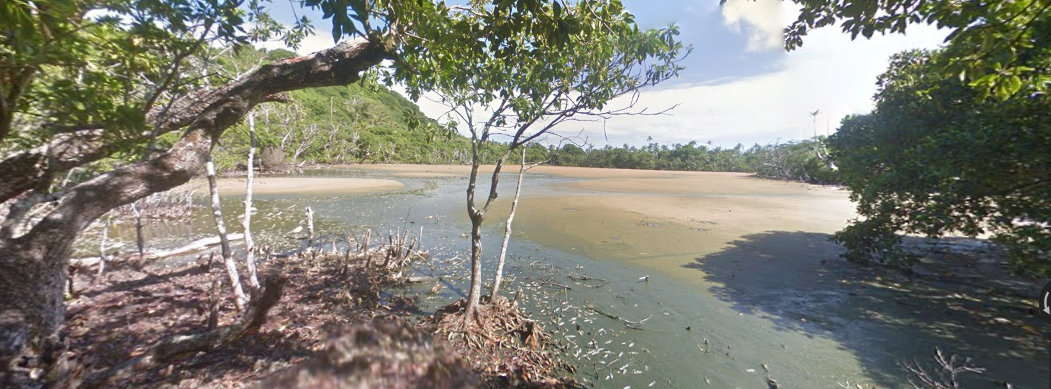
Beach to the immediate left of Aunu'u Harbor, facing Tutu'ila Island.

Evacuation Point, at the crossroads between Taufusitele Marsh and Lalopapa Marsh.
If a tsunami warning sounds, run here!

Cove near Pala Lake
Quicksand at Pala Lake
Even google couldnt get close enough to catch a glimpse through the thick foliage to spot the shrieking eels that infest Red Lake. I hope we can find a guide who may be able to bring us near.
Finally, here is a picture of Aunu'u from the air, showing the geographical features of the island:
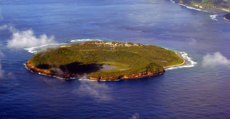
You can see Red Lake and Pala Lake, and you can see that the evacuation point is the highest point on the island. Red Lake looks so accessible here! It's hard to believe that the thick brush prevents anyone from approaching the lake and her eels.